• We provide comprehensive and high-quality Drone Lidar Services at competitive prices and in quick turnaround time. Our experience includes delivering 50+ projects of varied sizes and complexities to renowned Lidar companies across the globe. • Lidar drones are any drones made to carry a Lidar sensor. They are used to collect data that can be used to make detailed 3D models for a variety of applications and industries. • Lidar sensors can help provide some of the most accurate and high resolution 3D models available. • It is widely used in logistics drones, mapping drones, formation performance drones, driving test aircraft, etc.
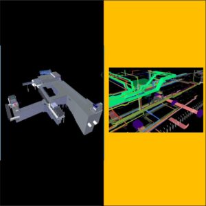
2. MOBILE LIDAR
• We’re experienced in a wide range of data processing software systems, and we can provide your Lidar data in your preferred format. • We have a dedicated Lidar vertical Department that possesses core competence in numerical analytics, 3D and 2D modeling, design optimization, Lidar technology in Mobile, etc. • Mobile Lidar, or 3D laser scanning, is one of the fastest, most efficient ways to collect spatial data. Our non-invasive technologies capture all required data-point measurements in a single pass, speeding up your processes and eliminating the need for additional mobilization costs.
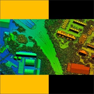
3. Terrestrial Lidar
• We have experienced and dedicated Team in Terrestrail Lidar and our company so many projects completed in Terrestrail Lidar • Lidar is the process of using a laser beam combined with a rangefinder to capture the size and position of all visible surfaces and objects. Terrestrial, or ground based, LiDAR is suitable for relatively small areas
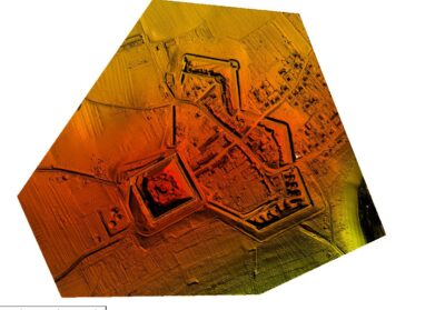
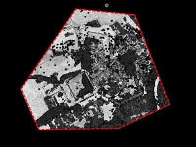
4. AIRBORNE LIDAR
• Airborne Lidar is used to measure land – surface elevation hidden amid the vegetation conopy also by detecting elevation changes between repeat surveys , Lidar has revealed processes our landscapes • we have owning our own aircraft and deploying the most advanced technologies • Hantech provide our clients fast, accurate, and high-quality data through our airborne Lidar services. Airborne Lidar provides extraordinary efficiency and speed in gathering accurate spatial data and is integrated with our image sensors to provide simultaneous Lidar and image acquisition.