
PHOTOGRAMMETRY
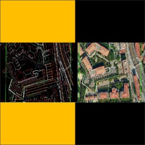
1.Aerial Triangulation
• Hantech offering a wide range of Surveying Services that include Contour Survey, Surveying Services, Topological Survey, Railway Engineering Survey, Detail Engineering Survey and Levelling Services. Our flawless range of services is offered in land development works.
• Aerial Triangulation is a technique for establishing the relative position of two or more points. Aerial triangulation (AT) is a method for producing maps by overlapping aerial images.
• Aerial triangulation represents the process for determining the correct position and orientation of each image in a series of aerial images so they can be compiled into a map
Line map of the project area showing flight lines
• Project boundaries.
• Control point locations and identification numbers.
• Description of Ground Control Points with coordinates.
• Estimates of horizontal and vertical accuracy of Ground Control Points.
• Camera calibration report.
• Technical specifications.
2. Topographic / Planimetric Mapping
• A planimetric map presents only the horizontal positions of the features represented. It is distinguished from a topographic map by the omission of relief, normally represented by contour lines.
• Topographic Maps are essential instruments for a variety of monitoring and planning activities of Various data sources are used to build mapping products
• Our team has extensive knowledge in Planimetric. And our company provides all these services CAD, digital terrain models (DTMs) of the application of advanced spectral processing to extract features and information for use in spatially-referenced business system
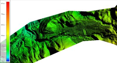
3.DEM/DTM / Contour Genration
• Hantech provides DTM/DEM services to its clients in a much faster manner
• DTM generation. A digital terrain model (DTM or DEM) is a threedimensional representation of the earth’s surface, represented as an array of points with a defined height. The terrain model contains information about the height without considering vegetation, buildings, and other objects.
• In many cases, you may need to convert a DEM from a digital surface model (DSM) to a digital terrain model (DTM). A DSM represents the elevation surface, including objects, such as buildings and trees, whereas a DTM represents a bare-Earth elevation surface. For this reason, using a DTM to perform orthorectification generally produces better results
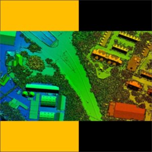
4. Orthphoto genration /Mosaning /Tilling
• An orthophoto, orthophotograph or ortho image is an aerial
photograph /satellite images/drone images or image
geometrically corrected (“orthorectified”) such that the scale is
uniform: the photo has the same lack of distortion as a map.
Our Orthophoto generation Services include
• Multi sensor image fusion
• Ortho rectification and Orthophoto interpretation
• Color balancing and image mosaicing
• Object based image classification
• Seamline editing and
• Tile cutting
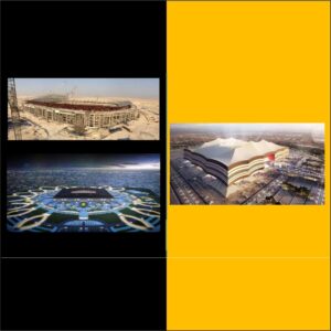
5. 3D City and Features Modeling
• Hantech offers a 3D city and features modeling services in
Domestic services
• 3D city model is a digital representation of the Earth’s surface and
it’s related objects such as Building, Tree, Vegetation, and some
manmade feature belonging to urban area.
▪ We offers
• GIS data. …
• CAD data. …
• BIM data. …
• Integration at visualization level. …
• Building reconstruction.